
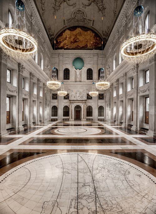
 The largest maps in the entire world can be found in
the floor of the Citizens’ Hall, in the heart of the Royal Palace Amsterdam. The three maps of the world and the night sky each measure an
astonishing 624 centimetres in diameter. They are an essential part of the
design conceived by the architect Jacob van Campen for this building: his
entire concept was based on creating the impressive town hall as a miniature
universe.
The largest maps in the entire world can be found in
the floor of the Citizens’ Hall, in the heart of the Royal Palace Amsterdam. The three maps of the world and the night sky each measure an
astonishing 624 centimetres in diameter. They are an essential part of the
design conceived by the architect Jacob van Campen for this building: his
entire concept was based on creating the impressive town hall as a miniature
universe.
The Universe of Amsterdam
Treasures from the Golden Age of cartography - 29 June until 22 September
The Universe of Amsterdam
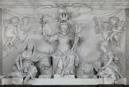
In the
Citizens’ Hall, marble reliefs with the four elements (Earth, Water, Fire, and
Air) and garlands of flora and fauna together make up the terrestrial microcosm.
Statues of Roman gods in the corners of the surrounding galleries symbolise the
planets of our solar system, the macrocosm. Enthroned at the centre of this
universe is the Maid of Amsterdam, above the entrance to the hall. The world
and the night sky are literally spread out at her feet.
This was an unequivocal
statement.
The plotting
of the celestial map
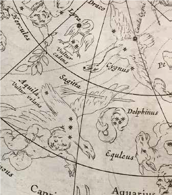
It was recently discovered that the map of the night sky looked completely different in the seventeenth century. When the map was first made, line drawings on the marble indicated the contours of the groups of stars, or constellations, that are known by the names of human types, animals, or objects, such as Orion, the Great Bear, or Libra (=scales).
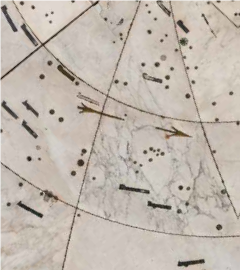
These are depicted in old maps as actual figures.The marble map shown here was modelled on the map of the night sky published by
Willem Blaeu in 1628. Parts of the constellations were inlaid in metal in the
floor.
These include the club wielded by Hercules, although the god himself is
no longer visible: all the painted lines were worn away centuries ago.
The Golde Age of cartography
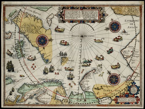 In the former town hall, nowadays the Royal Palace Amsterdam, three spectacular maps were inlaid in the floor. Even
today, they are still the largest maps ever made. This is not surprising, when
we recall that Amsterdam was then the world’s leading cartography centre. The
best and most ambitious cartographers worked in the immediate vicinity of the
town hall.
In the former town hall, nowadays the Royal Palace Amsterdam, three spectacular maps were inlaid in the floor. Even
today, they are still the largest maps ever made. This is not surprising, when
we recall that Amsterdam was then the world’s leading cartography centre. The
best and most ambitious cartographers worked in the immediate vicinity of the
town hall.
An unimaginable number of maps and atlases were published here, containing
a treasure trove of knowledge. They brought the world within reach of the
interested general public.
In this exhibition you will learn the story behind the maps in the Citizens’ Hall and see the most beautiful maps and atlases made in the seventeenth and eighteenth centuries. This exhibition was produced in partnership with Allard Pierson│ The Collections of the University of Amsterdam.